Australia’s colonial history continues to unearth surprises. Bathurst historian Robin McLachlan, an Adjunct Senior Lecturer at Charles Sturt University, made an amazing discovery among the digitised images of the UK National Archives: an amazing 1815 map, signed by Governor Macquarie himself.
Over the past couple of years I have been working for Bathurst Regional Council researching the settlement established by Governor Macquarie in 1815. One of my tasks has been to locate early maps, plans and pictures held by major Australian archives and libraries. High-resolution digital scans are then acquired of interesting items, enabling us to create a locally accessible reference collection of some amazing material.
In May, I had a tip-off that the National Archives in London held the plans for Bathurst’s Convict Hospital, but I didn’t hold out any hope that I would find anything more on their website than a file reference. Wrong! Their Image Library provided a digital colour image. What a find!
Curious to see what else might be in the Image Library, I ploughed on (in my armchair) with searching on key words and working my way through several hundred thumbnail images looking for anything useful. (I looked at an awful lot of photographs of Bathurst in Gambia!)
Perseverance paid a dividend. I struck a find even more astonishing than the Convict Hospital. I found an 1815 map of inland New South Wales.
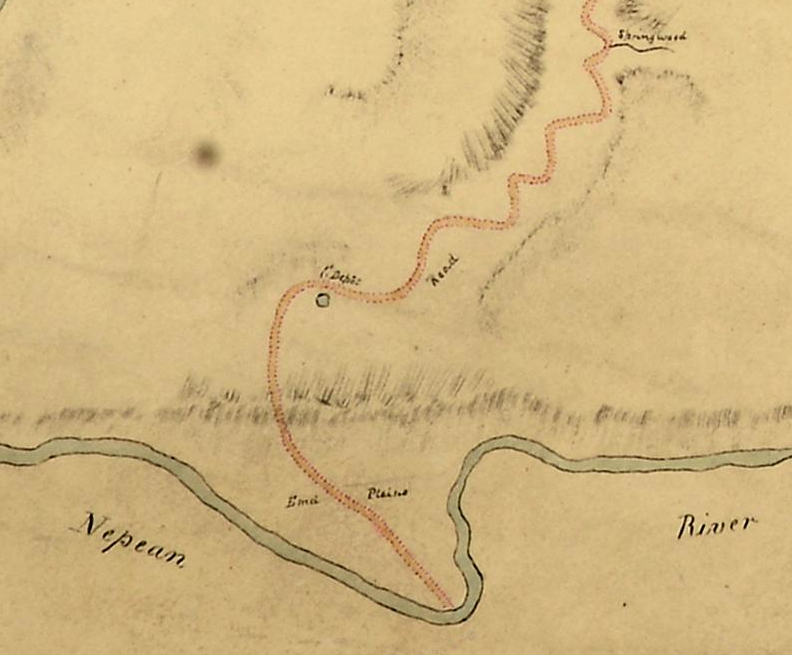
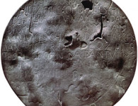
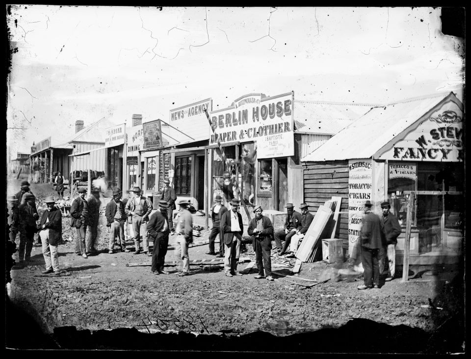
The start of Cox’s Road on the rediscovered map. Courtesy National Archives, ID CO700/NEWSOUTHWALES24.
It was a map showing Cox’s Road from its starting point on the Nepean River all the way to its terminus at Bathurst. Also marked on the map was a rough sketch of Macquarie’s proposed town plan for Bathurst and scattered observations on the country traversed by the road and, beyond Bathurst, the country explored by Surveyor George Evans in 1814.
What is this map? Who made it? Why was it made?
The map is entitled, “Map of the Country to the Westward of the Nepean River, New South Wales. 1815”. It is signed by Governor Macquarie and is attributed by the National Archives to Surveyor General John Oxley, although I cannot see his name on the map.

Macquarie’s signature on the map. Courtesy National Archives, ID CO 700/NEWSOUTHWALES24
Drawn on a scale of two miles to the inch, it is a largish map on two joined sheets. I would not describe it as the best example of colonial cartography I have encountered, but rather it looks to be a map prepared in a rush with limited information at hand. It was that “rushed” look that drew me towards identifying the map’s possible origin.
I think there is a connection between this map and Governor Macquarie’s despatch to London, dated 24 June 1815 (Despatch No.7 of 1815). This is when he reported on his journey to Bathurst in May 1815 and the action he had taken in establishing a depot there. He also reported that the road to Bathurst (Cox’s Road) had been completed. In this despatch, he referred to an enclosed map, “A Chart of the country I travelled over nearly extending to the termination of Mr Evans’ First Tour”. This map would appear to be that “chart”, a map prepared from limited information during that window between Macquarie’s return to Sydney and the despatch of his report. (A transcription of this despatch can be found in Historical Records of Australia (1916), Volume 8. See p.557 for the reference to the “chart”.)
The map seems little known in Australia, which is surprising given the widespread and longstanding interest in the history of Cox’s Road. I have not yet found a reference to it in publications. But, there it is, digitised and on the National Archives website. You can see a low-resolution version for yourself for free and purchase your own high-resolution digital scan for £35, about 10 megabytes, delivered immediately.
With the bicentennial of the building of Cox’s Road literally around the corner, historical societies located along the line of the road will find the digital map worth having printed in full-scale size for display. My printed version is pinned up and looks quite splendid.
TO FIND THE MAP
To locate the map on the National Archives website, follow these steps:
- Go to the UK National Archive website: nationalarchives.gov.uk
- Then, scroll down the page to the link with the Image Library and click on that.
- On the Image Library page, go to the search box and type: C0 700/NEWSOUTHWALES24
This should take you to the map.


2 Comments
What an exciting discovery! It’s not easy to view on TNA’s website, so I think a visit to Kew might have to be planned.
Thanks for sharing your find with us. I have family connections with this area, which makes it even more interesting to me.
In response to Frances’s comment, I recommend the less expense option of purchasing the download of the map, at £35. It is delivered immediately to your email address. It is only about ten megabytes in size, so even those with less than broadband (like most of us!) should be able to handle it. Then you might like to take the digital copy on a thumb drive to an art print shop for a full size reproduction (1.17 m X 0.7 m).
The version available on-line is only a low resolution copy. What I have included with my blog is from the purchased high resolution digital copy I purchased.
The Bathurst District Historical Society currently has my printed copy on display at the Museum. We will be making considerable use locally of the map both with the bicentenary of the road and of Bathurst itself over the coming year.
Robin McLachlan