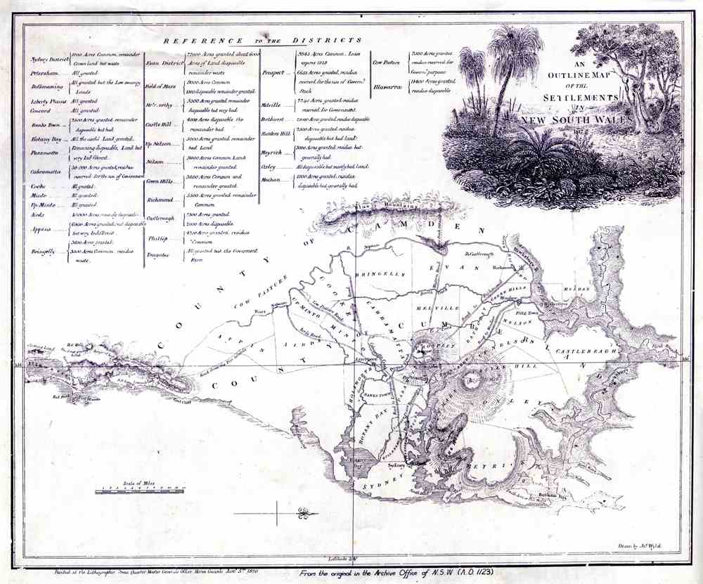
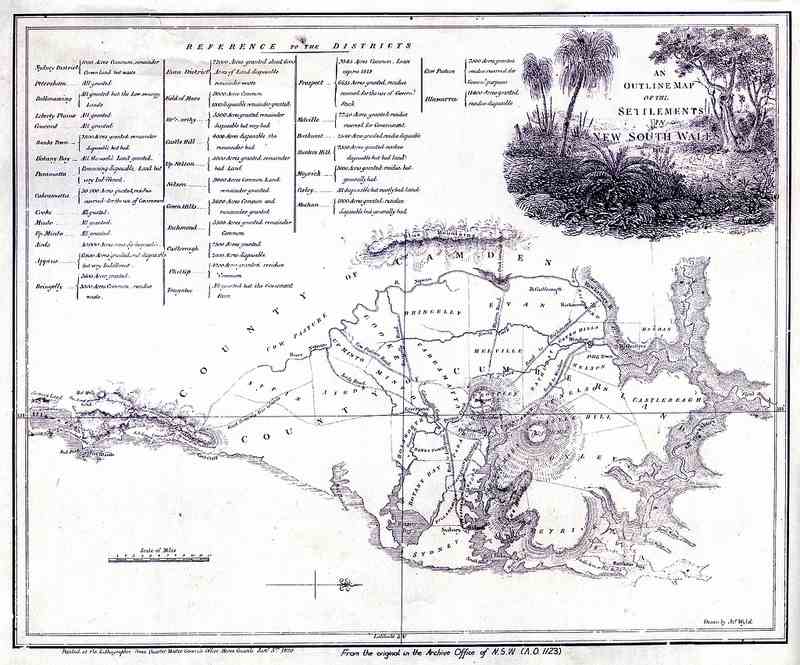
An Outline Map of the Settlements in NSW 1817
Notes: From the original in the Archive Office of NSW (AO 1132)
Relief shown by hachures.
Map shows 35 districts, with acreages of land grants and comments on quality of residue.
Oriented with north to the right, this map covers the County of Cumberland, but extends from Lake Illawarra to Hawkesbury River, and from Port Jackson to the Nepean River.
Illustration of bush scene drawn by B. King surrounds the title in upper right corner.
In top left corner: Reference to the districts.
Publication details appear at foot of map below the neat line.
Format: map on paper, drawn by James Wyld (1790-1836), 35.4 x 43.4 cm, on sheet 41 x 52 cm.
Date Range: original printed 1820, flickr dates stop at 1825
Location: covers the County of Cumberland, the Illawarra and part of the Blue Mountains
Licensing: Attribution, share alike, creative commons
Repository: Blue Mountains City Library bmcc.ent.sirsidynix.net.au/client/en_AU/default/
Part of: Local Studies Collection
Provenance: donation
Links: www.sl.nsw.gov.au/collection-items/outline-map-settlement...
This photo is in 1 group
- Trove: Australia in Pictures 375,342 items
This photo is in 1 album
- Maps, Guides, Illustrations 32 items
This photo is currently not in any galleries